Drive Overview
The Rim of the World Highway follows portions of Highway 18 through the San Bernardino Mountains, connecting mountain communities including Running Springs, Lake Arrowhead, Crestline, and areas near Big Bear Lake.
Most visitors exploring from Big Bear begin by heading west on Highway 18 toward Running Springs before continuing along the scenic ridgeline portions of the highway.
The byway itself stretches between:
- Cajon Pass near Interstate 15
- Mill Creek Canyon near Highway 38
Because of the multiple connecting highways and mountain towns, you can customize the drive depending on how much time you want to spend exploring.
A popular scenic loop includes:
- Big Bear Lake
- Running Springs
- Rim of the World Highway
- Crestline or Lake Arrowhead
- Return via Highway 38 through Angelus Oaks
Depending on stops and detours, most visitors should plan for:
- 2–4 hours minimum
- Longer if stopping for meals, hikes, or village exploring
This drive is especially popular for:
- Photography
- Scenic overlooks
- Casual mountain exploring
- Day trips
- Fall color drives
- Visitors wanting broader mountain views beyond Big Bear Lake
Adventure pass
Many popular stops along Big Bear's scenic routes are located on National Forest land where an Adventure Pass may be required.
Traveling with A Dog?
This route is best for dogs that are comfortable riding in the car for extended periods. While there are scenic turnouts along the way, there are fewer opportunities to stop and walk compared to other drives, and traffic can make spontaneous stops difficult.
Best Stops Along The Way
Green Valley Lake
Green Valley Lake is one of the quieter mountain communities along the route and makes a peaceful stop between Big Bear and Lake Arrowhead.
The small alpine lake offers:
- Picnic tables
- Easy walking paths
- Restrooms
- Dock access
- Calm mountain scenery
Compared to busier tourist areas, Green Valley Lake tends to feel slower-paced and more relaxed.
Keller Peak Fire Lookout
Keller Peak Lookout sits at nearly 7,800 feet and offers some of the best panoramic views in the region. During operating months, visitors can climb the historic fire lookout tower and see:
- Inland Empire views
- Mt. Baldy
- Forest ridgelines
- Catalina Island on exceptionally clear days
The road to the lookout can be rough in sections, and higher-clearance vehicles are recommended depending on conditions.
This is one of the best stops for photography along the Rim drive.
Lake Arrowhead Village
Lake Arrowhead Village makes an easy detour for visitors wanting food, shopping, or lakeside scenery during the drive.
Popular activities include:
- Walking the lakefront boardwalk
- Dining beside the water
- Coffee shops and bakeries
- Boutique shopping
- Seasonal events and live music
Because the Village sits directly off the main mountain routes, it works well as a lunch or mid-drive break.
Rim of the World Overlooks
Several scenic turnouts along Highway 18 offer sweeping views across the valleys below the San Bernardino Mountains.
Popular viewpoint areas include:
- Rim Forest Scenic Overlook
- Cloudland Vista Point
- Panorama Point
These stops provide some of the most dramatic scenery on the entire route and are especially scenic during:
- Sunrise
- Late afternoon lighting
- Clear days after storms
- Fall color season
Most overlook areas include safe pullouts and interpretive signs.
Best Time of Year
The Rim of the World Scenic Byway is accessible year-round, but visibility and road conditions can vary significantly depending on season and weather.
Spring
Spring often brings some of the clearest skies of the year along with greener forest scenery and fewer crowds. Snow may still remain at higher elevations during early spring.
Summer
Summer offers full access to overlooks, trails, and mountain towns, though afternoon traffic can increase during weekends and holidays.
Fall
Fall is one of the best seasons for this drive thanks to cooler temperatures, excellent visibility, and changing colors throughout portions of the mountain forests.
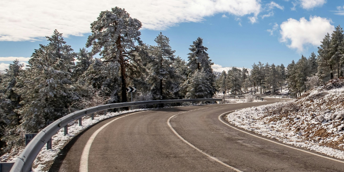
Winter
Winter can create some of the most dramatic scenery along the Rim drive, especially after fresh snowfall. However, winter weather can also bring:
- Chain controls
- Temporary closures
- Ice on shaded curves
- Reduced visibility during storms
Always check road conditions before traveling during winter months.
More Scenic Drives
THings to Know Before you Go
Mountain Roads
The Rim of the World Highway includes winding mountain roads, steep grades, and elevated ridgeline driving. Drivers unfamiliar with mountain roads should allow extra time and expect slower speeds throughout much of the route.
Some overlook pullouts are directly beside active roadways, so use caution when parking and walking near traffic.
Chain Requirements
Winter storms frequently impact Highway 18 and connecting mountain highways throughout the Rim drive area.
Before visiting during winter, check:
- Caltrans road conditions
- CHP chain requirements
- Mountain weather forecasts
Carry chains during winter months even if conditions appear clear when leaving Big Bear Lake.
Adventure Pass
Several scenic pullouts, forest roads, picnic areas, and trailheads along the Rim drive may require a San Bernardino National Forest Adventure Pass.
This can apply to:
- Forest parking areas
- Hiking trailheads
- Some overlook pullouts
- Recreation areas near the highway
Requirements vary depending on the specific stop and season.
Additional Tips
- Plan extra time for scenic pullouts and photography stops
- Wildlife sightings are common near forested sections, especially around sunrise and sunset
- Bring layers — temperatures can vary considerably throughout the route
- Cell service can become unreliable in some mountain areas
- Early mornings often provide the clearest views and lightest traffic
- Afternoon haze can reduce valley visibility during warmer months
Check the Weather
Mountain weather changes quickly throughout the year. A sunny morning can turn into afternoon rain, snow, wind, or fog depending on the season. Dress in layers and check conditions before leaving.
Fuel Up
Gas stations become less common outside the main town areas, especially on longer scenic drives. It’s best to fuel up before starting your route, particularly during weekends and busy holiday periods.
Cell Service
Cell service can become unreliable in parts of the San Bernardino Mountains, especially near forest roads, overlooks, and canyon areas. Download maps offline if possible and avoid relying entirely on GPS navigation.
Wildlife
Wildlife sightings are common throughout the area, especially during early morning and evening hours. Deer, hawks, coyotes, and even black bears may be seen near forested sections of the drive. Slow down and stay alert.
Rim of the World Byway
A Classic Mountain Highway Adventure
At A Glance
The Rim of the World Scenic Byway showcases dramatic mountain overlooks, dense pine forests, and winding ridgeline highways high above the valleys below. It’s one of the best drives near Big Bear for photography, scenic pullouts, and expansive mountain views.
Drive Quick facts
Discover More of Big Bear Lake
There's so much to see and do in every season. Explore hiking trails, wildlife, attractions, and more.