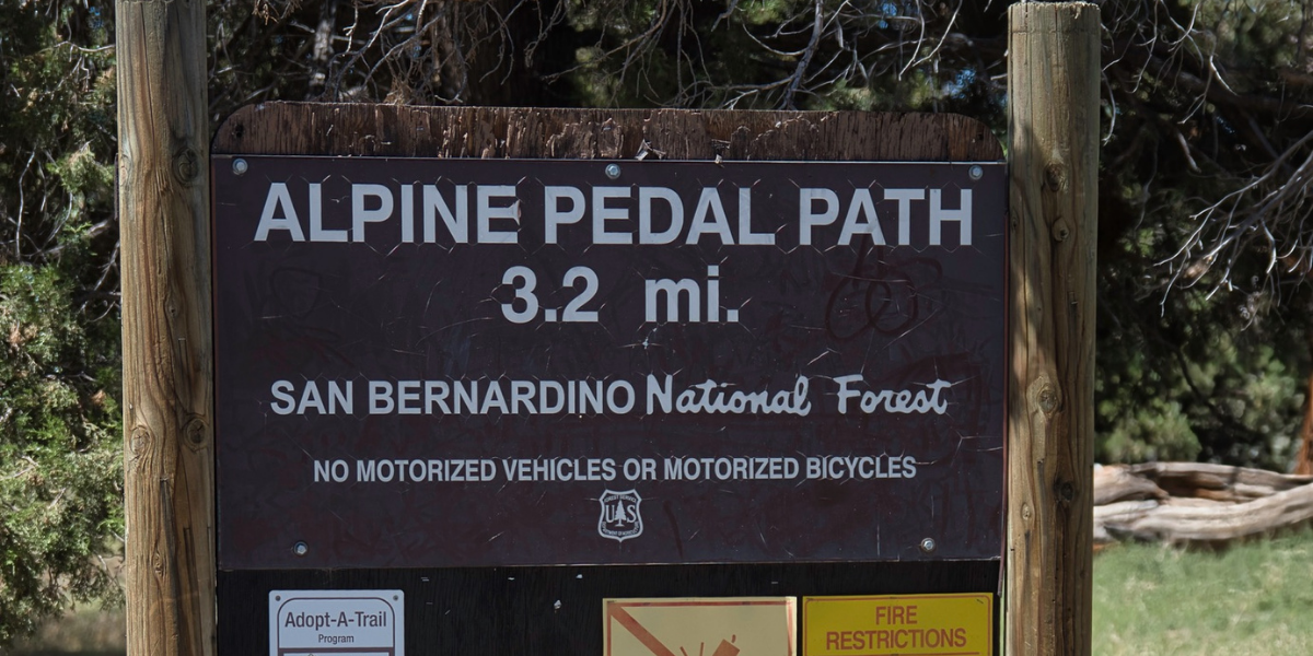
Alpine Pedal Path
Big lake views, easy walking, and one of the best ways to experience the shoreline.
Trail Quick Facts
At A Glance
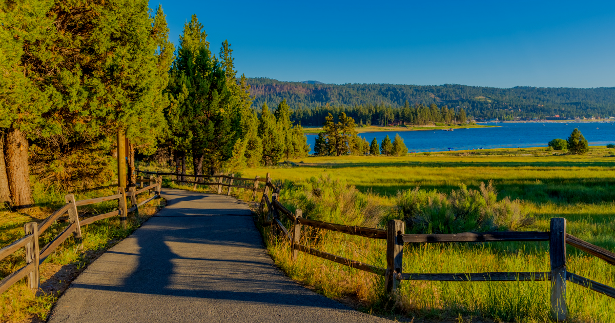
A scenic 3.2-mile paved path along Big Bear Lake's north shore. Perfect for walking, biking, strollers, and dogs, it offers some of the easiest lake access and best shoreline views in Big Bear.
About the Trail
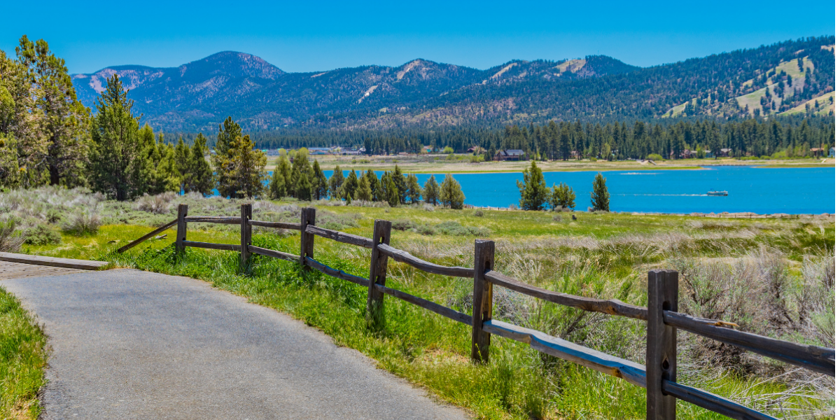
The Alpine Pedal Path is one of Big Bear's most popular trails because it combines beautiful lake views with an easy, accessible route that almost anyone can enjoy. The paved path follows the north shore from Stanfield Cutoff to Serrano Campground, providing continuous views of Big Bear Lake, the surrounding mountains, and the ski slopes across the water. Unlike many mountain trails, there are no steep climbs or difficult sections, making it a favorite for families, casual walkers, cyclists, runners, and visitors pushing strollers.
One of the biggest draws of the Pedal Path is how close it stays to the lake. Throughout the route you'll find places to stop for photos, sit on a bench, or walk down to the shoreline. The trail is wide enough that it rarely feels crowded, even during busy weekends, and the mix of open views and shaded sections keeps the walk interesting from start to finish.
Local Insight
Many visitors only walk the first section near Stanfield Cutoff. If you continue past Meadows Edge Picnic Area, you'll often find quieter stretches of trail with fewer people and some of the best uninterrupted lake views along the route.
Trailhead Directions & Parking
The official western trailhead for the Alpine Pedal Path is located at Stanfield Cutoff, where the paved path begins along the north shore of Big Bear Lake. While this is the most popular place to start, parking at the trailhead itself is limited and often fills quickly on summer weekends, holidays, and busy afternoons.
As you continue driving east along North Shore Drive, you'll find several additional access points with parking areas at locations including Juniper Point Picnic Area, Meadows Edge Picnic Area, and near Serrano Campground. Many of these parking areas are located on U.S. Forest Service land, so an Adventure Pass or Interagency Pass may be required. Always check posted signs before leaving your vehicle.
During busy periods, it's also common to see visitors parking along portions of North Shore Drive near trail access points where parking is permitted.
Another convenient option is to park at the Big Bear Discovery Center and access the Pedal Path via the 1E50.1 Spur Trail, which passes safely under Highway 38 through a pedestrian tunnel and connects directly to the main trail. This option provides access to restrooms, visitor information, and trail maps before you begin your walk.
Loading trail...
Important Trail Information
The Alpine Pedal Path is one of the busiest recreation trails in Big Bear, especially on summer weekends, but its wide paved surface means it rarely feels crowded. You'll share the path with walkers, runners, cyclists, families with strollers, and people walking their dogs, so staying aware of others is part of the experience.
One thing many first-time visitors don't realize is how easy it is to access the lake from the trail. Several sections run directly along the shoreline, allowing you to step off the pavement and spend time by the water. This makes the Pedal Path one of the few trails in Big Bear where you can combine a walk, beach access, and lake views all in a single outing.
If you're visiting in winter, expect occasional snow and icy patches in shaded sections after storms. During summer, the path has a mix of sun and shade, so mornings and evenings tend to be the most comfortable times to visit.
Dog Friendly Trail Reminder
Many Big Bear trails allow dogs, but mountain conditions can be more challenging than they appear. High elevation, warm summer temperatures, rocky terrain, wildlife, and limited water sources can all affect your dog's comfort and safety. Bring plenty of water, keep dogs leashed, and choose a trail that matches your pet's age, fitness level, and experience.
Terrain
- Smooth asphalt for nearly the entire route
- A few short wooden boardwalk sections
- Wide enough for two-way traffic (walkers + cyclists)
Distance & Elevation
The full trail runs 3.2 miles one way (Stanfield Cutoff to the Serrano Campground / Solar Observatory area). Most visitors treat it as an out-and-back walk or ride, choosing their distance based on time and energy.
There’s minimal elevation gain, so you won’t need to prepare for a strenuous hike.


Connecting & Nearby Trails
1E50.1 Spur Trail (Pedestrian Tunnel)
This short connector trail allows visitors to safely pass under Highway 38 through a pedestrian tunnel, linking the Alpine Pedal Path to nearby trailheads and the Big Bear Discovery Center without crossing traffic.
Cougar Crest Trail
Looking for more of a challenge? Cougar Crest Trail branches off from the Spur Trail and climbs into the mountains above Big Bear Lake. The higher you climb, the better the views become, making it a popular next step for hikers who want more than a casual lakeside walk.
Big Bear Discovery Center
Located just beyond the Spur Trail, the Discovery Center is a great place to stop for trail maps, exhibits, current trail conditions, and information about local wildlife and recreation opportunities. It's an easy addition to any walk on the Pedal Path.
Safety Note:
Trail conditions, accessibility, distances, elevation, and pet policies can change without notice. Always check official sources for current weather, trail status, and regulations before visiting. Discover Big Bear Lake provides this information for general reference only and assumes no responsibility for accuracy, safety, or any injuries, damages, or losses that may occur while using or visiting these trails.
Need A Trail Map?
Visit the Big Bear Discovery Center on the North Shore to speak to a ranger, learn about trail conditions and access trail maps.
Need AN Adventure Pass?
Learn more about when an Adventure Pass is required to be displayed and where you can purchase one.
Plan Ahead
Before you Hit the Trail
Best Time to Go
Late spring through fall offers the most reliable trail conditions. Morning hikes are usually cooler and less crowded during summer.
Bring Plenty of Water
Big Bear sits above 6,700 feet elevation, and the dry mountain air can dehydrate hikers faster than expected.
Wear Proper Footwear
Many trails include rocky terrain, loose dirt, roots, and uneven sections that can become slippery after rain or snow.
Check Conditions Before You Go
Weather, closures, snow, and trail conditions can change quickly in the mountains, especially during winter and spring.
Discover More of Big Bear Lake
There's so much to see and do in every season. Explore hiking trails, wildlife, attractions, and more.